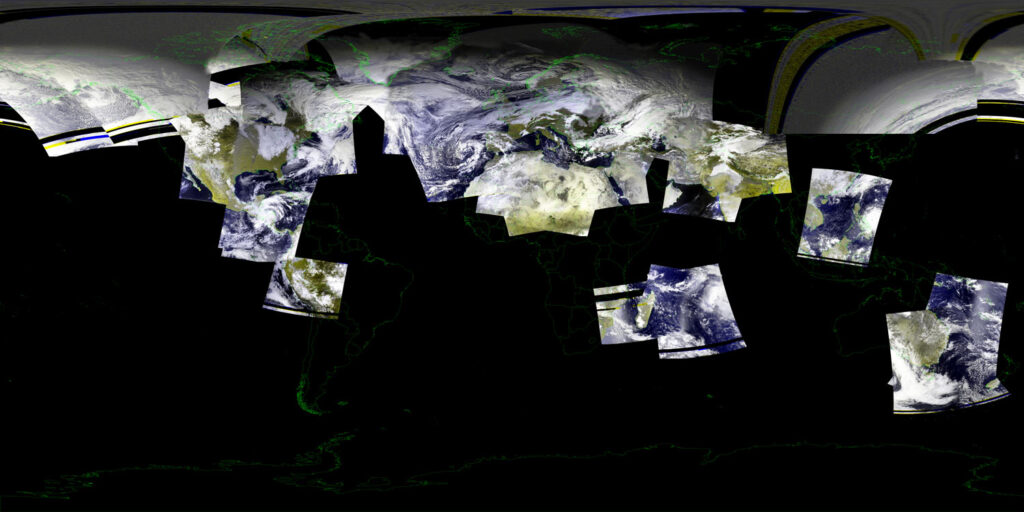
Over on the /r/amateursatellites subreddit, user elmarkodotorg is organizing a group megaprojection project. The Megaprojection Project seeks to create a composite of as much of the earth as possible from weather satellite images captured by hobbyists in a single day, via data from NOAA and Meteor polar-orbiting satellites. They will be accepting HRPT or LRPT data from either Nov 30 or Dec 1 (date yet to be confirmed).
Hobbyists can receive these satellites’ LRPT and HRPT signals using an RTL-SDR and appropriate antenna setup.
If you want to contribute, you can join DerekSGC’s Discord server, https://sgcderek.github.io, where coordination will be carried out. elmarkodotorg writes that currently, they have confirmed contributors with stations from the west coast of the US all the way over to the western edge of Asia. Currently, they are still hoping to find contributors from the Canary Islands, Turkey, Equatorial Africa, the general area of Indonesia, and Northern Australia. In a more recent Reddit thread, elmarkodotorg provides a link to a Google docs sheet, where you can also register interest.
Recently, on November 16 a test was carried out and they were able to successfully combine 24 images received across the world.


